Rolling Valley, Burke's southeast side along Sydenstricker and Hooes roads, is in ZIPs 22152 and 22153 and zoned for West Springfield High.
Last checked Oct. 19, 2026. Sources: Fairfax County’s open geospatial data (subdivision records, FCPS 2026-27 attendance areas and park boundaries), the Virginia Department of Historic Resources, the Virginia Department of Education’s School Quality Profiles, Zillow Research, Fairfax Connector and OpenStreetMap.
Rolling Valley is Burke’s southeast side, the neighborhoods along Sydenstricker Road and Hooes Road between Old Keene Mill Road and the Fairfax County Parkway. It is named for Rolling Valley, the largest subdivision in the county’s records here, and covers about 626 acres. It is a different place from the Rolling Valley West subdivision in Five Forks.
What this means for you
- Zoned high school: West Springfield High for the whole area. Check an address on the FCPS boundary locator.
- Home value: $676,192 in ZIP 22152 and $740,679 in 22153 in September 2026, according to the Zillow Home Value Index.
- Nearest interstate exit: I-95 exit 166, Fairfax County Parkway, about 5 miles by road.
Part of our Burke neighborhoods guide.
Where it is
The Fairfax County Parkway runs along the area’s southern side, with an interchange at Sydenstricker Road and Gambrill Road. Sydenstricker Road and Hooes Road are the main roads inside it. The area is split between two Springfield mailing addresses, 22152 (55%) and 22153 (45%), but the Census Bureau counts all of it as Burke.
The county’s subdivision records name the neighborhoods here. The largest are Rolling Valley (about 358 acres), Keene Mill Station, Bramblewood, Olde Oak Ridge, Innisfree and Knolls at Middle Run.
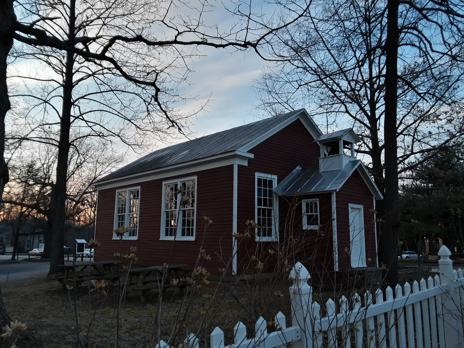
Sydenstricker School, 8511 Hooes Road, stands at the area’s edge. The Virginia Department of Historic Resources says it was the last one-room schoolhouse built in Fairfax County and the last one operating when it closed in 1939; it was listed on the National Register of Historic Places on Aug. 22, 2012. The Upper Pohick Community League has owned it since 1954. More in our history guide.
The area is in the Pohick Planning District of the county’s Comprehensive Plan. Fairfax County, not a town, runs police, fire and planning here.
Schools
Shares are of the area’s land in Fairfax County Public Schools’ 2026-27 attendance areas. Every school listed is Fully Accredited for 2025-26 on Virginia’s School Quality Profiles; pass rates are for all students on the 2025-26 Standards of Learning tests.
| Level | School | Share of the area | Reading pass rate | Math pass rate |
|---|---|---|---|---|
| High | West Springfield High, 6100 Rolling Road, Springfield | 100% | 95% | 92% |
| Middle | Irving Middle, 8100 Old Keene Mill Road, Springfield | 100% | 88% | 85% |
| Elementary | Hunt Valley Elementary, 7107 Sydenstricker Road, Springfield | 86% | 89% | 89% |
| Elementary | Orange Hunt Elementary, 6820 Sydenstricker Road, Springfield | 12% | 88% | 89% |
| Elementary | Rolling Valley Elementary, 6703 Barnack Drive, Springfield | 2% | 80% | 76% |
Check the exact address on the FCPS boundary locator. More in our schools guide.
Home values
According to the Zillow Home Value Index, the typical home value was $676,192 in ZIP 22152 in September 2026, up 0.6% from $672,343 a year earlier, and $740,679 in 22153, up 1.6% from $728,908. The index is a modeled typical value for the middle third of homes, not a sale price, and each figure covers a whole ZIP code. Zillow’s figure for all of Burke was $718,780. More in our home prices guide.
Parks and trails
From the county’s park boundary data and the Park Authority’s amenity list:
- Pohick Stream Valley Park runs through the area along Pohick Creek. The park has paved and unpaved trails and a basketball court.
- Middle Run Stream Valley Park reaches into the area, with a paved trail.
- Orange Hunt Estates Park, 8650 Sandy Drive, Springfield, is next to the area, with a paved trail, a playground and a basketball court.
More in our parks and trails guide and walking and biking trails guide.
Getting around
- Interstate: I-95 exit 166, Fairfax County Parkway, about 5 miles by road from the middle of the area, and exit 169, Old Keene Mill Road, about 6 miles, by the exit numbers in OpenStreetMap.
- Commuter rail: about 4.2 miles to the Rolling Road VRE station and 5.1 miles to Burke Centre station.
- Airports: about 15 miles to Ronald Reagan Washington National Airport and 22 miles to Washington Dulles International Airport.
Distances are measured on the OpenStreetMap road network with the OSRM routing engine from the middle of the area; they are not drive times.
- Buses: Fairfax Connector Route 305 (Newington Forest to Silverbrook Road) stops in the area, according to Fairfax Connector’s current schedule data. Plan a trip with WMATA’s trip planner.
More in our getting around guide.
Groceries and everyday stores
OpenStreetMap shows no supermarket or pharmacy inside the area. The nearest, about 0.6 mile away near Old Keene Mill Road and Rolling Road in West Springfield, include:
- Trader Joe’s, 8402 Old Keene Mill Road, and Walgreens, 8414 Old Keene Mill Road
- Aldi, 6230 Rolling Road
How we drew this area
The area is the Fairfax County subdivisions in Burke’s Census boundary that lie mostly in the Hunt Valley or Rolling Valley elementary attendance areas. School and ZIP shares are land shares in the county’s map data, checked Oct. 19, 2026, not address counts. Store and road locations are © OpenStreetMap contributors.
Frequently asked questions
What schools is Rolling Valley in Burke zoned for?
On the FCPS 2026-27 map the whole area is zoned for Irving Middle and West Springfield High, and 86% of it for Hunt Valley Elementary, 7107 Sydenstricker Road. All three are Fully Accredited for 2025-26.
What ZIP code is Rolling Valley?
It is split: 55% of the area is in 22152 and 45% in 22153, both Springfield mailing addresses inside Burke’s Census boundary. Zillow’s typical values in September 2026 were $676,192 and $740,679.
What is Sydenstricker School?
A one-room schoolhouse built in 1928 at 8511 Hooes Road, listed on the National Register of Historic Places on Aug. 22, 2012. Virginia’s Department of Historic Resources says it was the last one-room schoolhouse built in Fairfax County.
Which bus serves Rolling Valley?
Fairfax Connector Route 305, Newington Forest to Silverbrook Road, stops in the area, according to Fairfax Connector’s current schedule data.
Have your say